


Antioch Voting District, White County, Arkansas
About
Outline

Summary
| Unique Area Identifier | 528464 |
| Name | Antioch Voting District |
| County | White County |
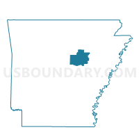
| State | Arkansas |
| Area (square miles) | 14.65 |
| Land Area (square miles) | 14.65 |
| Water Area (square miles) | 0.00 |
| % of Land Area | 100.00 |
| % of Water Area | 0.00 |
| Latitude of the Internal Point | 35.14172930 |
| Longtitude of the Internal Point | -91.93973040 |
Maps


Graphs
Select a template below for downloading or customizing gragh for Antioch Voting District, White County, Arkansas


Neighbors
Neighoring Voting District (by Name) Neighboring Voting District on the Map
- Cane Voting District, White County, AR
- Coffey Voting District, White County, AR
- Crisp Voting District, White County, AR
- Union Voting District, White County, AR
Top 10 Neighboring County Subdivision (by Population) Neighboring County Subdivision on the Map
- Union township, White County, AR (9,421)
- Cane township, White County, AR (1,738)
- Coffey township, White County, AR (1,196)
- Chrisp township, White County, AR (1,107)
- Antioch township, White County, AR (562)